
Why Scotland Looks Best From the Air
Why Scotland Looks Best From the Air
Scotland is one of those places that changes completely when you see it from above.
On the ground, it is already impressive. You have the mountains, lochs, beaches, islands, winding roads, old villages, empty spaces and weather that seems to change every ten minutes.
But from the air, it all starts to make sense.
You see the shape of the land. The way the roads cut through the glens. The way the rivers twist through the valleys. The way the coastline breaks into beaches, cliffs, inlets and islands. You see how small we are in the middle of it all.
That is what I like about drone photography in Scotland.
It gives you a view you cannot get from the side of the road.
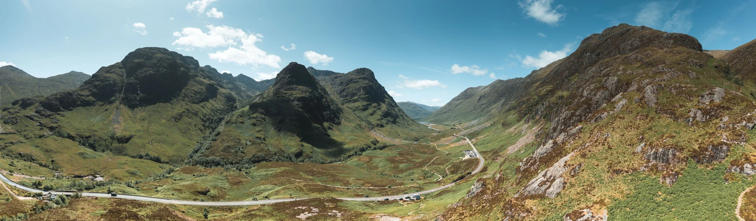
Glencoe
A place like Glencoe is powerful from ground level, but from the air you see the scale of it. The road becomes a line through the landscape. The mountains feel bigger. The space opens up.
The same goes for the west coast, Skye, the Highlands and the small roads that run through the middle of nowhere. From the ground, you see one view at a time. From above, you see the whole scene.
That is why Scotland works so well as aerial photography.
It has shape.
It has texture.
It has weather.
It has roads that look like they were made for a camera.
Some of my favourite images are not complicated. A road through a valley. A small vehicle in a big landscape. A beach with clear water. A loch surrounded by hills. A stretch of coastline that looks almost untouched.
There is something about Scotland from the air that makes the image feel quiet, even when the weather is rough.
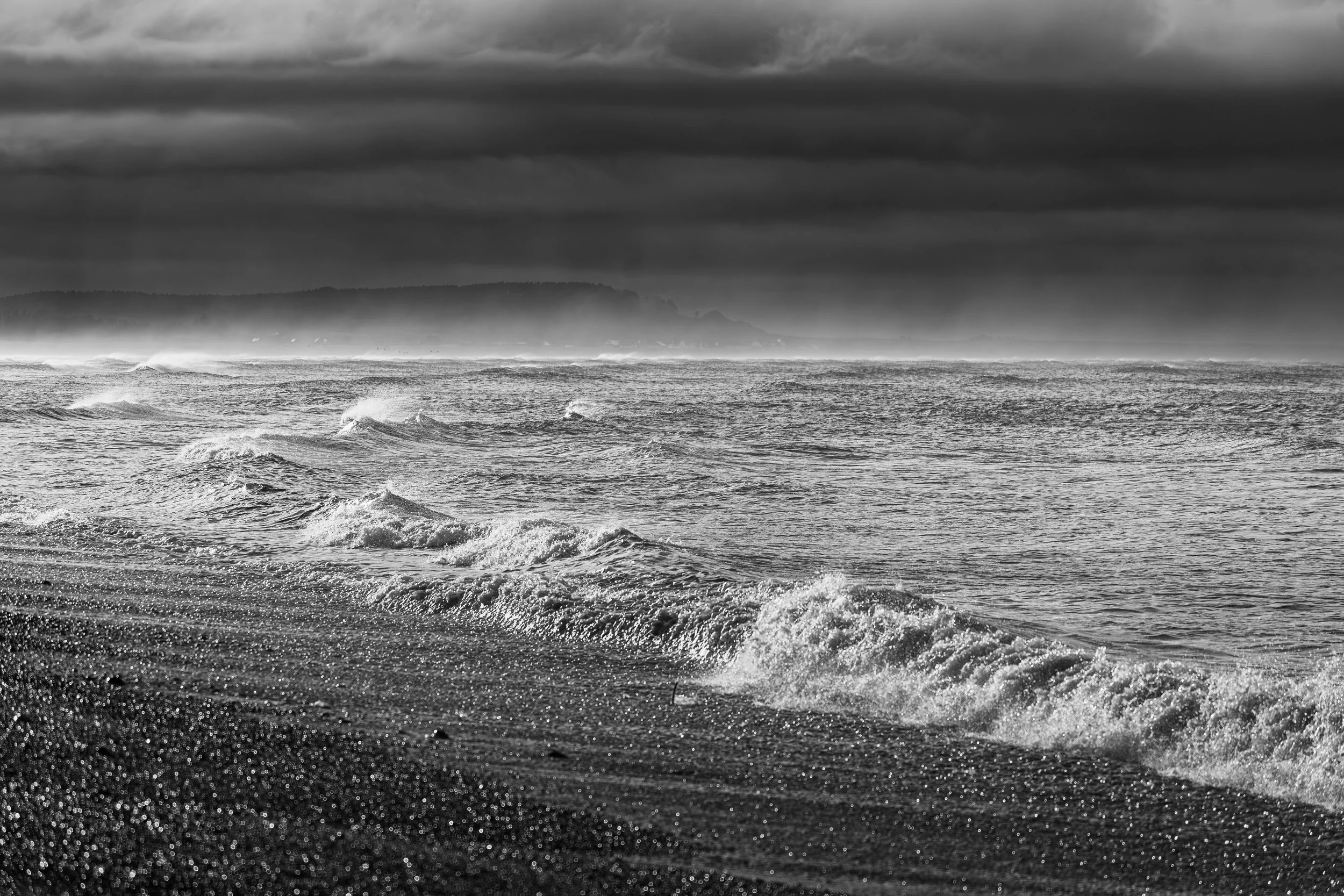
The Coast Fraserburgh
The drone lets me show the landscape in a way that feels honest. I am not trying to make Scotland look perfect. It does not need that. The wildness is the point. The empty roads, the rough hills, the dark water, the low cloud and the sudden burst of light are what make it interesting.
A lot of people think drone photography is just about going high.
It is not.
For me, it is about finding the right angle. Sometimes that means going up. Sometimes it means staying low and using the drone like a tripod in the sky. The best aerial shots are not always the highest ones. They are the ones where the shape of the landscape comes together.
Scotland gives you that constantly.
A bend in the road.
A line of trees.
A white beach beside dark water.
A camper on an empty track.
A mountain ridge disappearing into cloud.
These are the details that make an image work.
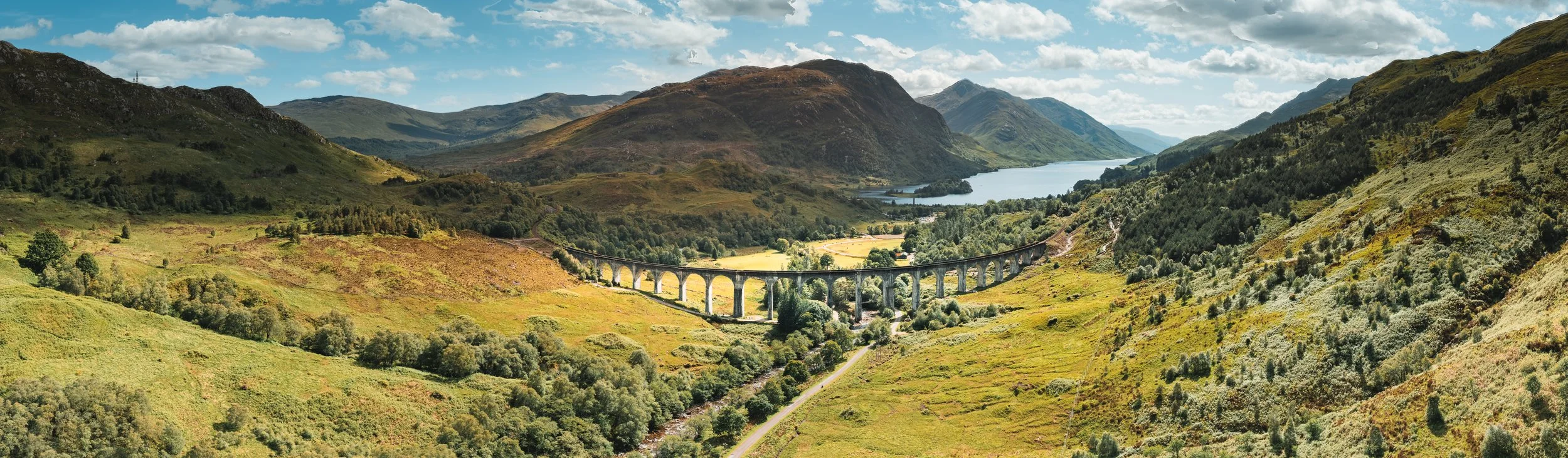
Glenfinnan Viaduct
Travelling through Scotland with Donna gave me time to really look at it. Not just rushing from one famous spot to the next, but stopping, waiting, watching the light and seeing what was actually there.
That is when the best photographs happen.
You can plan a location, but you cannot plan the weather, the light or the moment. Scotland reminds you of that all the time. You can have rain, wind, flat grey skies and then suddenly, for a few minutes, everything changes.
That small break in the weather can make the shot.
I think Scotland looks best from the air because it shows the country for what it is — rugged, open, dramatic and still full of empty places.
It is not just scenery. It is space.
That is what I want people to feel when they look at my Scotland prints.
The sense of being out there.
The road ahead.
The weather moving in.
The quiet.
The scale.
The feeling that you could keep driving and still not see it all.